Tag: nature

  • Mawsmai Caves: Unveiling Meghalaya’s Stunning Limestone Formations!

    Mawsmai Caves: Unveiling Meghalaya’s Stunning Limestone Formations!

    Mawsmai Caves are one of the most popular tourist attractions in Meghalaya, located near the town of Sohra (Cherrapunjee), about 6 kilometers from the main town. These limestone caves are a natural wonder, known for their stunning formations, fascinating history, and easy accessibility, making them a must-visit for anyone traveling to the region.

    How to Reach Mawsmai Caves

    Reaching the Mawsmai Caves in Meghalaya is relatively straightforward, especially if you are traveling from Shillong or Cherrapunjee (Sohra).

    1. By Air

    • Nearest Airport: The closest airport to Mawsmai Caves is Lokpriya Gopinath Bordoloi International Airport in Guwahati, Assam, about 170 kilometers from Shillong.
    • From the Airport to Shillong:
      • You can take a taxi or a shared cab from the airport to Shillong, which is about a 3-hour drive (approximately 120 kilometers).
      • There are also regular helicopter services between Guwahati and Shillong.

    2. By Train

    • Nearest Railway Station: The nearest railway station is Guwahati Railway Station, which is well-connected to major cities in India.
    • From Guwahati to Shillong:
      • From the railway station, you can take a taxi or bus to Shillong, which is about 100 kilometers away and takes around 2.5 to 3 hours by road.

    3. By Road

    • From Shillong to Cherrapunjee (Sohra):
      • Distance: The Mawsmai Caves are located about 58 kilometers from Shillong, in Cherrapunjee (Sohra).
      • Travel Time: It takes approximately 2 hours to drive from Shillong to Cherrapunjee.
      • Route: The route from Shillong to Cherrapunjee is scenic, passing through lush green hills, waterfalls, and valleys. The most common route is via NH206 (previously known as SH5), which is well-maintained.
      • Transportation Options:
        • Private Taxi: You can hire a taxi from Shillong to Cherrapunjee. This is the most convenient option, allowing you to stop and enjoy the sights along the way.
        • Shared Cabs: Shared cabs are available from the main taxi stand in Shillong. These are more affordable but may take longer depending on the number of stops.
        • Public Buses: Meghalaya Transport Corporation (MTC) runs buses between Shillong and Cherrapunjee. The buses are less frequent but are an economical option.
    • From Cherrapunjee to Mawsmai Caves:
      • Distance: Mawsmai Caves are located about 6 kilometers from the main town of Cherrapunjee.
      • Travel Time: It takes about 15 to 20 minutes by car or taxi.
      • Transportation Options:
        • Private Taxi: You can hire a local taxi in Cherrapunjee to take you to Mawsmai Caves.

    4. Local Transport

    • Once you reach Cherrapunjee, local taxis are easily available to take you to Mawsmai Caves and other nearby attractions. It’s common to hire a taxi for the entire day to visit multiple sites in and around Cherrapunjee.

    Key Highlights of the Caves

    1. Limestone Formations

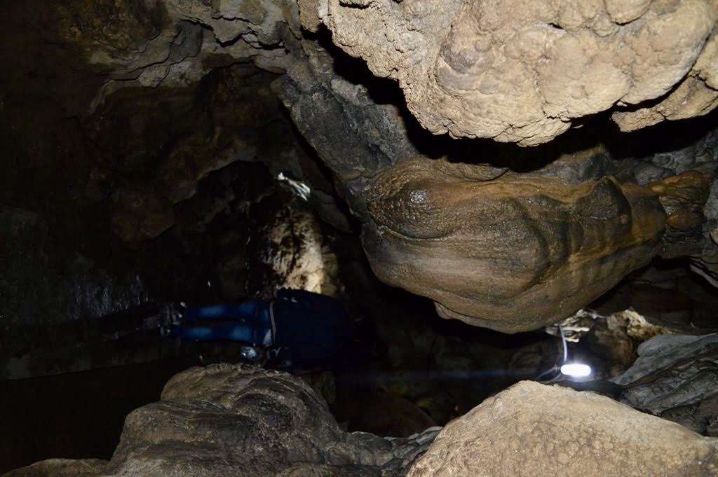
    • The Mawsmai Caves are renowned for their impressive limestone formations, including stalactites (hanging from the ceiling) and stalagmites (rising from the ground). These formations have been created over millions of years due to the slow deposition of minerals from dripping water.

    2. Natural Beauty

    • The caves are known for their natural beauty, with the interplay of light and shadow creating an otherworldly atmosphere inside. The caves are naturally lit in some sections, allowing visitors to see the intricate details of the rock formations.

    3. Accessible Cave System

    • Unlike some other caves in Meghalaya, Mawsmai Caves are easily accessible and well-maintained, making them suitable for visitors of all ages. The caves are about 150 meters long, with a well-defined path that allows for a comfortable exploration.

    4. Flora and Fauna

    • The area surrounding the caves is rich in biodiversity, with lush greenery and a variety of plant species. The entrance to the caves is surrounded by dense vegetation, adding to the experience of entering a hidden world beneath the earth.

    Exploration and Experience

    1. Entering the Caves

    • As you enter the Mawsmai Caves, you’ll immediately notice the cool, damp air and the natural rock formations that line the walls and ceiling. The entrance is relatively wide, but as you progress, the cave narrows, creating a sense of adventure.

    2. Navigating the Caves

    • The cave system is relatively short, and the path is well-marked, with natural light filtering in from openings in the ceiling. The caves are spacious in some areas, while in others, you may need to duck or squeeze through narrower passages, adding a bit of excitement to the journey.

    3. Admiring the Formations

    • As you move deeper into the cave, take time to admire the stunning limestone formations. The stalactites and stalagmites have taken unique shapes over millennia, with some resembling familiar objects or animals, sparking the imagination of visitors.

    4. Photography

    • The Mawsmai Caves offer excellent opportunities for photography, especially where natural light enhances the beauty of the formations. However, the lighting inside the caves can be dim, so a camera with a good low-light performance or a phone with night mode would be ideal for capturing the details.

    5. Best Time to Visit

    • The post-monsoon and winter seasons (October to May) are the best times to visit, as the caves are dry and easier to explore. During the monsoon season, the caves can become more challenging to navigate due to increased water levels and slippery conditions.

    Nearby Attractions

    • Nohkalikai Falls: The tallest plunge waterfall in India, located near Cherrapunjee, offers breathtaking views and a serene environment.
    • Seven Sisters Falls: Also known as Nohsngithiang Falls, this is a major attraction in the region, especially during the monsoon season when the falls are in full flow.
    • Living Root Bridges: Meghalaya is famous for its living root bridges, particularly in nearby areas like Nongriat, offering a unique blend of natural beauty and traditional Khasi ingenuity.

    Conclusion

    Mawsmai Caves offer an unforgettable experience for nature lovers, adventure seekers, and those interested in geology. The ease of access combined with the natural beauty inside the caves makes it an ideal destination for a day trip from Shillong or Cherrapunjee. Whether you’re captivated by the unique rock formations or simply enjoying the thrill of exploring a cave, Mawsmai Caves are a highlight of any visit to Meghalaya.

  • Discovering Mahabalipuram: Pallava Dynasty Treasures and Coastal Charms!

    Discovering Mahabalipuram: Pallava Dynasty Treasures and Coastal Charms!

    Mahabalipuram, also known as Mamallapuram, is a historic town located on the southeastern coast of India, in the state of Tamil Nadu. It is renowned for its ancient rock-cut temples, monolithic sculptures, and rich history that dates back to the Pallava dynasty. The town is located on the shore of Bay of Bengal making it a unique Ancient towns of India. The whole town is home to many ancient temples and beautiful architectures making it a must place to visit if someone is interested in ancient history and culture of India.

    Historical Background

    • Pallava Dynasty: Mahabalipuram flourished during the 7th and 8th centuries under the rule of the Pallava kings, particularly Narasimhavarman I, also known as Mamalla, after whom the town is named. The Pallavas were great patrons of art and architecture, and Mahabalipuram became a significant center for their artistic endeavors.
    • UNESCO World Heritage Site: In 1984, the Group of Monuments at Mahabalipuram was designated a UNESCO World Heritage Site due to its outstanding example of Dravidian architecture and its role in the development of South Indian temple architecture.

    Key Attractions

    1. Shore Temple

    • Overview: The Shore Temple is one of the most iconic structures in Mahabalipuram, built around 700–728 AD. It is named for its location on the shore of the Bay of Bengal.
    • Architecture: The temple is an excellent example of early Dravidian architecture and is a structural temple, as opposed to the rock-cut style prevalent in the area. It consists of two shrines dedicated to Lord Shiva and one dedicated to Vishnu.
    • Significance: The temple is known for its finely carved granite reliefs and its strategic position by the sea, which has led it to be a symbol of Mahabalipuram’s maritime history.

    2. Pancha Rathas (Five Rathas)

    • Overview: The Pancha Rathas are five monolithic temples, each carved out of a single large rock. These structures resemble chariots (rathas) and are named after the Pandavas from the Mahabharata, though they are not directly related to the epic.
    • Architecture: Each ratha has a unique architectural style, representing different types of temple architecture that later became common in South India. They are dedicated to various deities, and each ratha features intricate carvings and sculptures.

    3. Arjuna’s Penance (Descent of the Ganges)

    • Overview: Arjuna’s Penance is one of the world’s largest open-air rock reliefs, measuring about 27 meters long and 9 meters high. It depicts scenes from Hindu mythology, particularly the story of the descent of the Ganges River to Earth, facilitated by the penance of King Bhagiratha.
    • Significance: The relief is a masterpiece of Pallava art, featuring numerous figures, including gods, celestial beings, animals, and humans, all intricately carved into the rock face.

    4. Krishna’s Butterball

    • Overview: Krishna’s Butterball is a giant natural rock boulder perched precariously on a slope. Despite its seemingly impossible position, the boulder has remained stationary for centuries, defying gravity.
    • Cultural Significance: The boulder is associated with the myth of Lord Krishna stealing butter, symbolizing the playful aspect of the deity. It is a popular spot for tourists and photographers.

    5. Mahishasuramardini Cave Temple

    • Overview: This rock-cut temple is dedicated to the goddess Durga, depicted in her form as Mahishasuramardini, the slayer of the buffalo demon Mahishasura.
    • Architecture: The cave temple features intricate carvings and sculptures of Durga, as well as other deities. The artistic style of the carvings reflects the early Pallava art form.

    6. Varaha Cave Temple

    • Overview: The Varaha Cave Temple is another rock-cut temple, featuring carvings of Lord Vishnu in his Varaha (boar) incarnation, lifting the Earth goddess Bhudevi from the ocean.
    • Significance: The temple is noted for its fine bas-relief sculptures, which are excellent examples of Pallava craftsmanship.

    Cultural and Tourist Aspects

    • Dance Festival: Mahabalipuram hosts an annual dance festival during December and January, showcasing traditional Indian classical dance forms against the backdrop of its historic monuments. This festival attracts dancers and visitors from all over the world.
    • Craftsmanship: The town is also known for its stone carving and sculpture workshops, where artisans continue the ancient tradition of creating intricate stone sculptures. Visitors can purchase these sculptures as souvenirs or observe the craftsmen at work.
    • Beaches: Mahabalipuram’s coastline is known for its scenic beauty, with quiet beaches that offer a tranquil environment for relaxation. The beaches are also popular for surfing and other water sports.

    How and When to Visit

    • Location: Mahabalipuram is located about 60 kilometers south of Chennai, making it easily accessible for a day trip from the city. It can be reached by road via the East Coast Road (ECR), which offers a scenic drive along the coast. In the early morning the drive itself is a mesmerizing experience.
    • Transportation: The town is well-connected by buses and taxis from Chennai and nearby cities. It is also close to Chennai International Airport, which makes it accessible to international tourists. If you are visiting the town only for tourism I would recommend to make a trip of 3 days and clubbing it with the visit to Puducherry also.
    • When to Visit? Winter season is the ideal time to visit as it becomes very hot during the summer months. The ideal months are December and January.

    Conclusion

    Mahabalipuram is a town that seamlessly blends history, art, culture, and natural beauty. It offers a unique opportunity to explore the ancient architectural marvels of the Pallava dynasty while enjoying the serene coastal environment. Whether you are a history enthusiast, a culture lover, or a casual traveler, Mahabalipuram provides a rich and immersive experience that reflects the grandeur of South India’s heritage.

  • Loktak Lake: A Jewel of Manipur’s Culture and Biodiversity

    If there is one lake which has impacted the history and culture of a region the most then it is the Loktak Lake. Loktak Lake, located in the Indian state of Manipur, is the largest freshwater lake in northeastern India. It is renowned for its unique floating islands, rich biodiversity, and cultural importance. Although Manipur at present is in news due to ongoing conflict, however Loktak lake is one of the most beautiful and pristine water bodies I have been to till today.

    A View of Loktak Lake

    History of Loktak Lake

    1. Ancient Times: Loktak Lake has been an integral part of Manipur’s history for centuries. The lake and its surroundings have supported local communities through fishing and agriculture.
    2. Mythological Significance: Loktak Lake holds an important place in Manipuri mythology and folklore. It is often mentioned in the legends and stories of the Meitei people, the dominant ethnic group in Manipur.
    3. Recent History: In the mid-20th century, the construction of the Ithai Barrage for the Loktak Hydroelectric Project significantly altered the lake’s ecosystem. While the project provided electricity and irrigation benefits, it also led to ecological challenges and displacement of local communities.

    Geography

    1. Location: Loktak Lake is located in the Bishnupur district of Manipur, approximately 53 kilometers southwest of the state capital, Imphal.
    2. Floating Phumdis: The lake is famous for its phumdis, which are floating islands made of a heterogeneous mass of vegetation, soil, and organic matter. The largest phumdi hosts the Keibul Lamjao National Park, the only floating national park in the world.
    3. Hydrology: The lake covers an area of about 287 square kilometers and is fed by several streams and rivers, including the Manipur River. It drains into the Manipur River, which eventually flows into the Bay of Bengal.

    Tourism

    • Boating and Sightseeing: Tourists can enjoy boat rides on the lake, which offer scenic views of the floating phumdis and local fishing activities. Traditional canoes and modern boats are available for hire.
    Boating in Loktak Lake
    • Keibul Lamjao National Park: This unique national park, located on the southeastern shore of the lake, is home to the endangered Sangai deer (Manipur brow-antlered deer). The park’s floating meadows provide a unique habitat for this rare species.
    • Loktak Lake Tourist Complex: Located at Sendra Island, this tourist complex offers panoramic views of the lake and its surroundings. It features accommodation, restaurants, and a watchtower for bird watching and enjoying the scenic beauty.
    • Bird Watching: Loktak Lake is a haven for bird watchers, as it attracts a variety of migratory and resident bird species. Winter months are particularly good for spotting migratory birds.

    Cultural Significance

    1. Fishing Communities: Loktak Lake supports a large number of fishing communities who live in traditional huts on the phumdis. These communities have developed unique fishing techniques and cultural practices centered around the lake.
    2. Local Festivals: The lake plays a significant role in local festivals and rituals. The Loktak Day festival celebrates the cultural and ecological importance of the lake, promoting awareness and conservation efforts.
    3. Economic Importance: The lake is crucial for the local economy, providing livelihoods through fishing, agriculture, and tourism. It also supplies water for irrigation and hydropower generation.
    4. Folklore and Traditions: Loktak Lake is woven into the cultural fabric of Manipur, featuring in various folk songs, dances, and stories. It is considered a symbol of natural beauty and ecological richness in the region.

    Conclusion

    Loktak Lake is not just a natural wonder but also a vital part of Manipur’s ecological, economic, and cultural landscape. Its unique floating islands, rich biodiversity, and cultural heritage make it a fascinating destination for tourists and a precious resource for local communities. Preservation efforts are essential to maintain the ecological balance and sustain the livelihoods of those who depend on this extraordinary lake.

  • Lohagad Fort: Historical Marvel and Trekking Paradise in Maharashtra

    Lohagad Fort: Historical Marvel and Trekking Paradise in Maharashtra

    Lohagad Fort is located near Lonavala in Maharashtra. It is a significant historical fort with a rich past that dates back several centuries. The fort is perched on a hilltop at an elevation of around 1,033 meters (3,389 feet) above sea level. It offers a commanding view of the surrounding region.

    History of Lohagad Fort

    Ancient and Medieval Period

    • Initial Construction: The exact date of Lohagad fort’s construction is uncertain. However, it is believed to have been built during the Satavahana period, around the 1st or 2nd century BCE. The fort has seen numerous rulers and dynasties over the centuries, including the Satavahanas, Chalukyas, and Rashtrakutas.

    Maratha Period

    • Shivaji Maharaj’s Era: Lohagad gained prominence during the Maratha Empire, particularly under the rule of Chhatrapati Shivaji Maharaj. He captured the fort in 1648 from the Adil Shahi dynasty of Bijapur. The fort was strategically important due to its location. It was used to store loot from Shivaji’s successful campaigns. These included his raid on Surat in 1665.
    • Battle and Defense: Lohagad played a crucial role in defending the Maratha territories against the Mughal Empire and other enemies. The fort’s natural defenses, with steep cliffs on three sides, made it difficult to conquer.

    British Era

    • Capture by the British: After the fall of the Maratha Empire, Lohagad Fort eventually came under British control in 1818. This occurred following the Third Anglo-Maratha War. The British used the fort primarily as a garrison and a place to store ammunition.

    Architecture and Features

    • Design and Structure: Lohagad Fort is known for its robust architecture. It features four large gates, namely Ganesh Darwaja, Narayan Darwaja, Hanuman Darwaja, and Maha Darwaja. The fort also has several cisterns and water tanks, as well as a step-well.
    • Vinchu Kata: One of the most striking features of Lohagad is the “Vinchu Kata” (Scorpion’s Tail). It is a long and narrow wall-like structure that extends from the fort. It resembles a scorpion’s tail. This part of the fort offers breathtaking views of the surrounding landscape.
    Scorpion’s Tail

    Lohagad Fort stands as a testament to the rich history of Maharashtra and the Maratha Empire. It embodies the architectural brilliance and strategic acumen of the period.

    Trekking to Lohagad Fort

    Lohagad Fort is one of the most popular trekking destinations in Maharashtra, particularly for those seeking a relatively easy and scenic trek. The fort is located near Lonavala and is easily accessible from both Lonavala and Malavli.

    Starting Point

    • Malavli Station: The most common starting point for the trek is Malavli. It’s a small railway station located on the Mumbai-Pune route. Malavli is about 9 kilometers from Lonavala, and the trek to Lohagad begins here.
    • Reaching Malavli: You can reach Malavli by taking a local train from either Mumbai or Pune. From Malavli station, it’s a short walk through the village before you start the actual trek.

    Trekking Route

    • Route Overview: The trek from Malavli to Lohagad Fort is around 5 kilometers one way and takes about 1.5 to 2 hours, depending on your pace. The trail is well-marked and frequently trekked, making it easy to navigate. On the way to the fort there are proper steps making it easy to walk.

    Trail Description

    • Initial Walk: The trek begins with a walk along a mud road that gradually ascends towards the fort. You will pass through scenic landscapes, including green fields, small villages, and lush vegetation, especially beautiful during the monsoon season.
    • Bhaje Caves: En route, you will come across the Bhaje Caves. These are ancient Buddhist rock-cut caves. They date back to the 2nd century BCE. These caves are worth a visit if you have time and add a cultural element to the trek.
    • Final Ascent: After passing the Bhaje Caves, the trail becomes steeper as you approach the fort. The path is rocky but manageable, with stone steps leading up to the fort’s main entrance. The stone steps make this trek and easy and safe one. However, during heavy rain these steps become a drain for the water coming from the top of the fort. This makes it dangerous at times.

    Highlights of the Trek

    • Scenic Views: The trek offers breathtaking views of the surrounding Sahyadri mountain range. It also offers views of the Pawna Lake and the lush green valleys. This is particularly true during the monsoon season when the landscape is vibrant and the weather is cool.
    • Historical Significance: As you reach the fort, you’ll encounter the ancient gateways, walls, and structures. These tell the story of the fort’s historical importance. The Vinchu Kata, a narrow wall extending from the fort, offers panoramic views and is one of the trek’s highlights.
    • Monsoon Experience: Trekking to Lohagad during the monsoon is especially popular. The fort is enveloped in mist. The surrounding greenery is at its peak. However, the trail can be slippery, so trekkers need to be cautious especially the beginners.

    Difficulty Level

    • Easy to Moderate: The Lohagad trek is considered easy to moderate and is suitable for beginners, families, and even children. The well-paved trail and gentle gradient make it accessible for most people.

    Best Time to Trek

    • Monsoon Season (June to September): The best time to trek Lohagad is during the monsoon. The area is lush and the waterfalls are in full flow. However, the trail can be slippery, so proper footwear is essential. I will personally advise not to wear slippers and high heels.
    • Winter (October to February): Winter offers clear skies and cool weather, making it another excellent time for the trek. The visibility is good, providing stunning views of the surrounding landscape.

    What to Carry

    • Essentials: Comfortable trekking shoes. Water (at least 2 liters). Snacks. A raincoat or windcheater (during monsoon). A hat or cap. A small first aid kit.
    • Camera/Phone: To capture the scenic beauty and historic structures.
    • Light Jacket: If trekking in winter, a light jacket or sweater might be necessary.

    Reaching the Fort

    • Fort Exploration: Once you reach the top, you can explore various parts of the fort. This includes the four gates, water tanks, ancient temples, and the Vinchu Kata. The fort offers numerous vantage points to enjoy the breathtaking views. The fort also offers great view of Visapur Fort which is located in the vicinity. There are many good resorts located nearby and one can go and stay in these resorts for a relaxing time.

    Trekking to Lohagad Fort is a fulfilling experience, blending natural beauty with historical intrigue. Whether you’re a seasoned trekker or a beginner, Lohagad offers a rewarding journey. It is both physically manageable and spiritually enriching.

  • Discovering the Enchanting Araku Valley: A Hidden Gem in Andhra Pradesh

    Discovering the Enchanting Araku Valley: A Hidden Gem in Andhra Pradesh

    Araku Valley is a picturesque hill station located in the Eastern Ghats of Andhra Pradesh, India. Known for its breathtaking landscapes, coffee plantations, and rich cultural heritage, Araku Valley is a popular destination for tourists seeking natural beauty and tranquility. Located in Alluri Sitarama Raju District of Andhra Pradesh, Araku Valley is a beautiful but lesser known hill station in India. The place is located around 110 km from the city of Visakhapatnam and and is well connected from the city of Visakhapatnam via road and Rail transport.

    Araku Valley is home to many of the indigenous tribes and is mainly inhabited by the tribal population. The maximum population in Araku Valley is of Araku Tribes and that is the reason it is known as Araku Valley. The place is frequently visited by many tourists mainly from the Visakhapatnam city to get a respite from the scorching heat of the area as well as hustle and bustle of the city life.

    Geography and Climate

    • Location: Araku Valley is situated in the Visakhapatnam district of Andhra Pradesh, approximately 110 kilometers (about 75 miles) from the city of Visakhapatnam.
    • Altitude: The valley is located at an altitude of about 900 to 1,400 meters (2,953 to 4,593 feet) above sea level, providing a cool and pleasant climate throughout the year.
    • Climate: The region experiences a moderate climate, with temperatures ranging from 15°C to 25°C (59°F to 77°F) in summer and dropping to around 5°C to 18°C (41°F to 64°F) in winter. The monsoon season brings moderate to heavy rainfall, enhancing the valley’s lush greenery.

    Attractions and Activities

    • Coffee Plantations: Araku Valley is renowned for its coffee plantations. The coffee grown here, particularly the organic Araku Coffee, is famous for its unique flavor and aroma. Visitors can tour the plantations and learn about the coffee production process.
    • Borra Caves: Located about 35 kilometers from Araku, these limestone caves are one of the deepest caves in India. They feature impressive stalactites and stalagmites and are a major tourist attraction.
    • Tribal Museum: This museum showcases the culture, artifacts, and lifestyle of the indigenous tribes of the region, offering a glimpse into the rich tribal heritage of the Eastern Ghats.
    • Padmapuram Gardens: A beautiful botanical garden featuring exotic plants, tree-top huts, and a toy train. It’s a perfect spot for nature lovers and families.
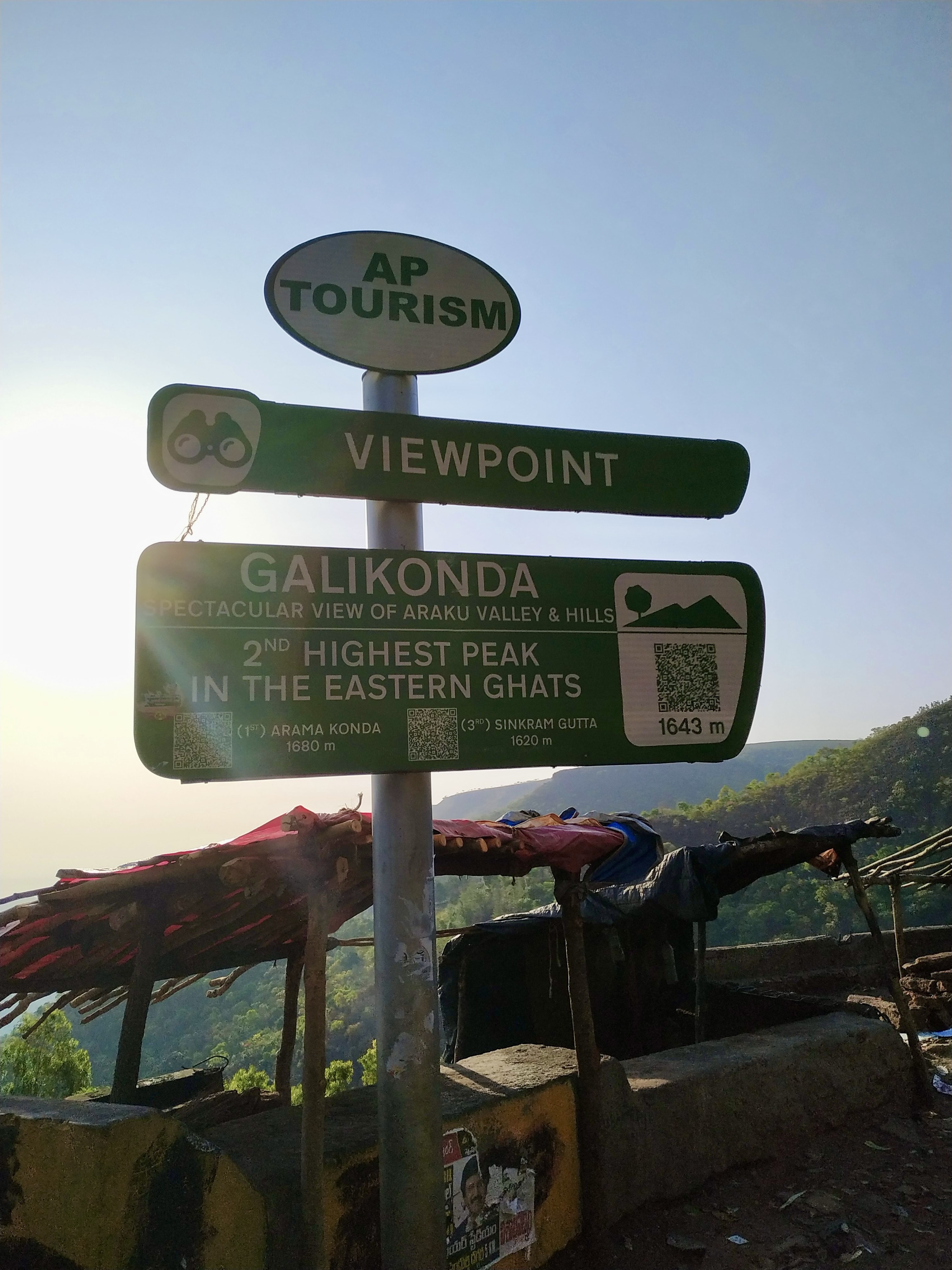
    • Galikonda Viewpoint: Offering panoramic views of the valley, this viewpoint is one of the highest points in the Eastern Ghats. It provides stunning vistas of the surrounding hills and forests.
    • Dumbriguda Waterfalls (Chaaparai): A scenic spot with cascading waterfalls, surrounded by lush greenery, ideal for picnics and nature walks.
    • Katiki Waterfalls: Located near Borra Caves, this waterfall is accessible via a short trek, offering a refreshing experience amidst nature.
    • Coffee Museum: A place dedicated to exploring the history of coffee and its various varieties. This was the best place that I visited in Araku Valley. The history and significance of various types of coffee is displayed on the walls beautifully.

    Cultural Heritage

    1. Tribal Culture: Araku Valley is home to several tribal communities, including the Araku, Gadaba, and Jatapu tribes. The region’s cultural heritage is rich with traditional dances, music, and crafts.
    2. Dhimal Dance: This traditional dance form is performed by the tribal women during festivals and special occasions, showcasing their vibrant culture.
    3. Local Markets: The weekly shandies (markets) are a great place to experience the local culture, where tribal people sell their handmade crafts, fresh produce, and traditional items.

    Accessibility

    • By Road: Araku Valley is well-connected by road. Regular buses and taxis are available from Visakhapatnam and other nearby towns.
    • By Rail: The Araku Valley Railway Station is part of the Visakhapatnam-Kirandul passenger line. The train journey from Visakhapatnam to Araku is particularly scenic, passing through tunnels, bridges, and lush landscapes. I would personally suggest to take the train journey via Vistadom coach to enjoy the lush green hills on the way.
    • By Air: The nearest airport is Visakhapatnam International Airport, about 115 kilometers away. From there, travelers can take a taxi or bus to reach Araku Valley.

    Conclusion

    Araku Valley is a hidden gem in Andhra Pradesh, offering a perfect blend of natural beauty, cultural richness, and serene ambiance. Whether you are a nature enthusiast, a coffee lover, or someone looking to experience tribal culture, Araku Valley has something for everyone.

  • Kashid Beach: Stunning White Sand Getaway in Alibaug, Maharashtra

    Kashid Beach: Stunning White Sand Getaway in Alibaug, Maharashtra

    Kashid Beach is a beautiful white sand beach located in Alibaug Taluka of Maharashtra. The beach is located nearby the Kashid Village in Murud Taluka and is becoming famous among the tourists due to its beautiful beach and less crowd as compared to the other beaches in the region.

    India has a huge coastline of around 7516 km. This has enabled the country to have beautiful natural beaches and many famous beach cities. We all know about the beaches on Goa, Kerala and Andaman and Nicobar. However there are still many beautiful beaches in India which are relatively lesser known but still very beautiful. The prime among them are the beaches in Alibaug.

    Famous Beaches of Alibaug

    Alibaug/Alibag is a coastal city and Municipal Council in Raigad district of Maharashtra. The city boasts of many beautiful natural beaches in its surroundings. The city is becoming famous as weekend getaway among the residents of Pune and Mumbai due to its beautiful beaches and closer proximity to these two cities. Few of the most famous beaches of Alibaug as as follows:

    • Alibaug Beach: A black-sand beach that offers views of the sunrise, sunset, and Kolaba Fort
    • Nagaon Beach: A popular beach with beach facing cottages and a view of the sunrise
    • Kashid Beach: A beach known for its sunsets
    • Varsoli Beach: A white-sand beach
    • Mandwa Beach: A serene and scenic beach
    • Kihim Beach: A picturesque and serene beach

    The other popular beaches are:

    1. Akshi Beach
    2. Kasim Beach
    3. Rewas Beach
    4. Korlai Beach
    5. Saswane Beach
    6. Revdanda Beach

    On our Alibaug trip this time we visited the Kashid Beach. The beach is beautiful and has many things to offer to the visitors.

    Kashid Beach

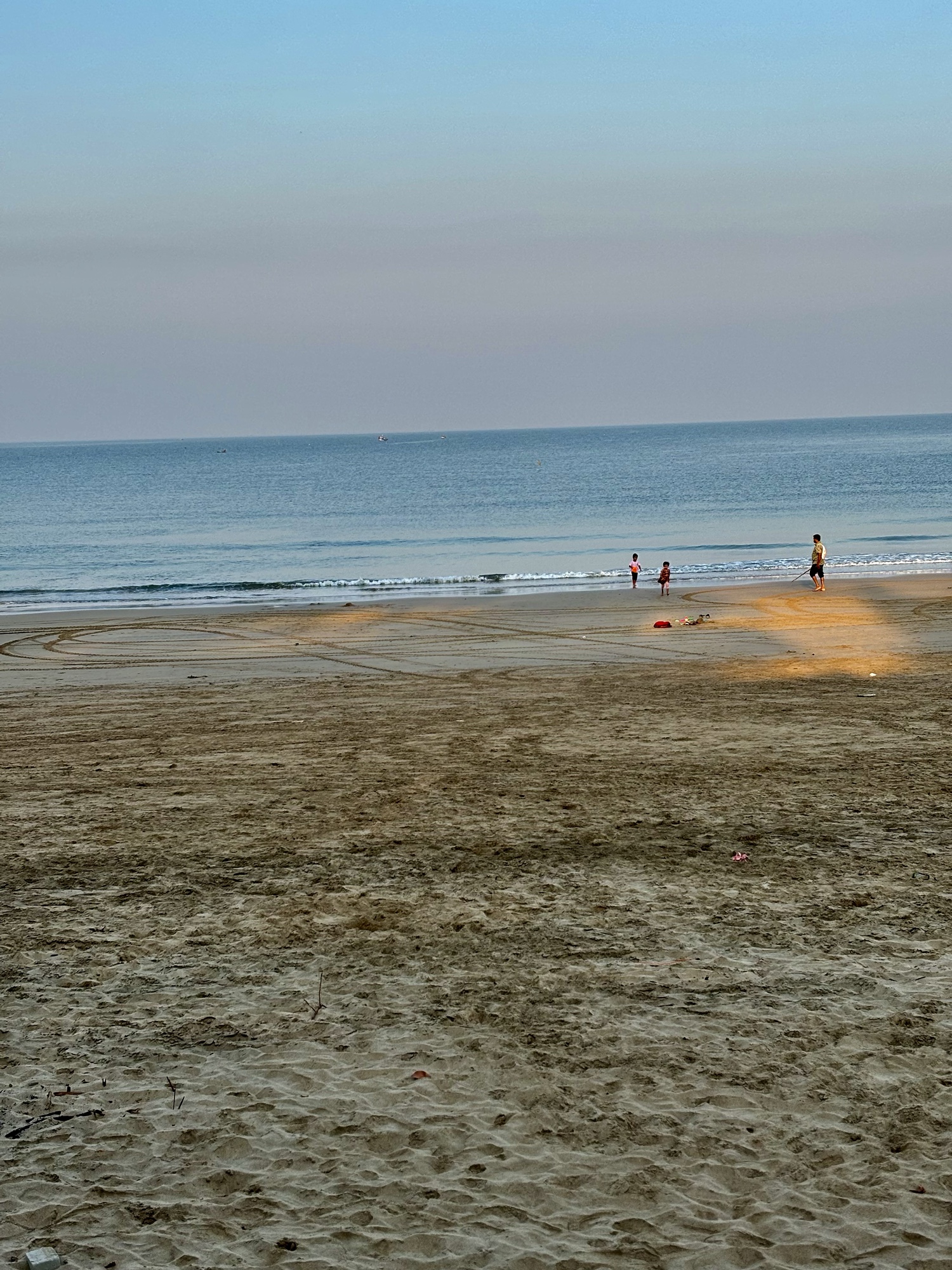
    Kashid Beach is known for its white sand, blue water, green mountains, and paddy fields. It’s also considered one of the cleanest beaches in the region. The beach is a popular weekend getaway from Mumbai and Pune. Kashid beach is a newly developed beach and is located at a distance of around 30 km from Alibaug. The beach is located in Kashid village which has traditionally been a fishing village but is fast becoming a tourist village due to Kashid Beach.

    How to Reach?

    Due to its difficult topography the place is not accessible via train. However one can reach Pune and Mumbai via train and then take either public transport or drive to Kashid Beach. The distance of Kashid Beach is around 174 Km from Pune and there are two different routes to reach from Pune. The first is vis Pune Mumbai Expressway which takes around 5 hrs to reach. The other route is through Tamhini Ghat. This route is a ghat route and takes around 4 hrs 30 minutes to reach. Although both the routes are good, I would personally recommend to take the Tamhini Ghat route. The traffic is less on this route and the road is scenic.

    If you are driving from Mumbai you can take the ferry to reach Alibaug and then drive from there(You can take your car inside the derry). This takes around 2 hrs 30 minutes to reach Kashid beach via this route. Alternatively you can drive via Mumbai sea link and reach Kashid beach. Its takes around 4 hours to reach kashid beach via this route. The roads are decent and the drive is scenic.

    The best part of our drive was crossing the Kundalika River. The view of river meeting the sea was beautiful.

    Where to Stay?

    There are many good resorts and homestays available at Kashid Beach. It is always better to stay at a resort which is offering food as well because there are not many eateries available nearby. We stayed at Prakruti Resort which is one the best resorts in the area. However it is on the costlier side so if you want to be on budget then you can take other resorts also which offer you a price range of around Rs 5k to 8k. Few of them are Kashid Beach Heritage Resort, O’Nest Resort etc. The beach is not very much crowded hence there is no particular need for taking a resort offering a private beach.

    Things to Do at Kashid Beach

    Although still relatively less developed There are many activities to do at Kashid Beach. The few of them are:

    1. Banana Ride
    2. Motor Boating
    3. Running
    4. Beach Volleyball
    5. Swimming
    6. Photography

    Other Places to Visit Nearby

    There are many beautiful beaches in the nearby area which one can visit while being in Kahid. The other place which I would personally recommend is Phansad Wildlife Sanctuary. The road from Kashid to Phansad is very scenic one can see many wild animals in the Sanctuary.

    Overall the visit to Kashid Beach is quite satisfying and a must recommended for everyone planning to visit a beautiful and peaceful beach.

  • Ellora Caves( एलोरा की गुफाएं): They Amaze You Every Time You Visit!

    Ellora Caves( एलोरा की गुफाएं): They Amaze You Every Time You Visit!

    We all have grown studying about Ajanta and Ellora caves and their beauty. However if someone has prepared for UPSC for sometime it becomes even more a thing of curiosity because these caves are a thing of great cultural importance not only for India but for the entire world. These caves are a living example of what indian culture has been in the past.

    My first experience of visiting the Ellora caves was in 2019 when I visited these caves with two of my friends. I visited Ellora Caves again in January 2023 and I must say both the times it was a magical experience. Standing in front of Kailash temple one gets lost in its grandeur and beauty.

    History of Ellora Caves

    The history of these caves dates back from 600 AD to 1000 AD. There are around 100 caves at the site out of which 34 are open to public. These caves belong to all three religions prevalent in the region at that time viz. Hinduism, Buddhism and Jainism.

    Counting wise Cave No 1 to 12 belong to Buddhism. Cave No 13 to 29 belong to Hinduism and Cave No 30 to 34 belong to Jainism. Although the entire complex of Ellora caves is a treasure to behold, the two most significant of them viz Cave no 10 called Vishwakarma cave and cave no 16 known as Kailash temple is discussed below.

    Cave No 10 (Vishwakarma Cave)

    Built in early 7th century this is the only Chaitya(Prayer Hall) in the series of Ellora Caves. Vishwakarma Caves are also known as ‘Sutur Ki Jhopdi’ in the local language. At the apsidal end of the chaitya hall is a stupa on the face of which a colossal high Buddha is seated in ‘Vyakhyana Mudra(teaching posture)’. A large Bodhi tree is carved at his back. Many of the Buddhist devotees come and prey in this caves daily even today. The cave is known as “Carpenter’s Cave”, because the rock has been given a finish that has the appearance of wooden beams.

    Entrance of Vishwakarma Cave( Carpenter’s Cave)
    Buddha in Vyakhyana Mudra in Carpenter’s Cave

    Cave No 16( Kailashnath Temple)

    Brief description of Cave no 16

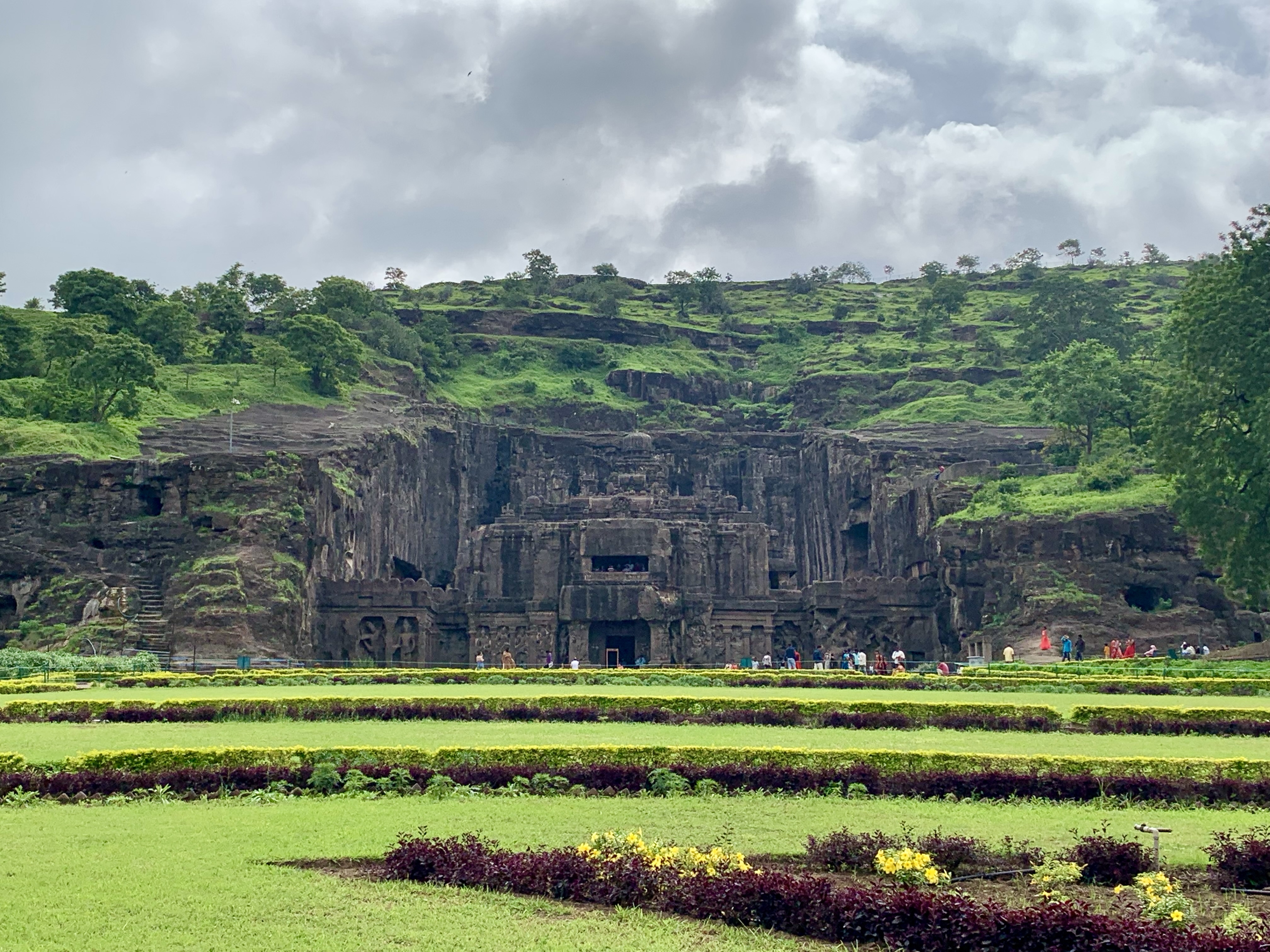
    Cave No 16 of Ellora Caves is also known as Kailasa(Kailashnath) Temple. The temple dedicated to Shiva is world famous for being the largest megalithic structure carved from the cliff face of a mountain. it is considered one of the most remarkable cave temples in the world because of its size, architecture, and sculptural treatment. It has been called as “the climax of the rock-cut phase of Indian Architecture”. According to the historical evidences the Kailasa temple was commissioned by Rashtrakuta Rulers during the 7th century AD. The temple looks very grand from the entrance itself and in my opinion it is the most beautiful structures in the entire cave architecture of India.

    View Of Kailasa Temple from the Entry Gate of Ellora
    Front View of Kailasa Temple from the Inside
    Side View of Kailasa Temple from the Inside

    How to Reach Ellora Caves?

    Aurangabad is the nearest city to Ellora Caves. The city is connected by both rail and road transport from all the major cities in India. There are ample of good hotels available in the city to stay. However I will that one should stay in the resorts nearby to the Ellora Caves. During the monsoon the area becomes very beautiful and there are very good views of the ancient city of Daulatabad. The best time to visit the Ellora Caves is during the monsoon or during the winter season. The area becomes quite hot during the summer time hence wondering around all the caves becomes exhausting during the summer time.

    Ellora Caves are one of the most astonishing rock cut structures in the world. They are India’s contribution to the entire humanity and they showcase the technological sophistication and the advancement of ancient India. Being the citizen of India it is recommended that everyone must visit them to appreciate the advancement of science, technology and spirituality in ancient India.

  • Sunrise at Kanifnath Trek: Beauty and Divinity!

    Sunrise at Kanifnath Trek: Beauty and Divinity!

    Kanifnath Trek is a unique trek near Pune city. The trek is neither a fort trek nor a hill trek, rather it is a ‘Tekdi’. Famous Kanifnath temple is located at the top of this tekdi. The trek is one of the offbeat locations near Pune city but is fast becoming famous because of being located near Pune city and the easy nature of the trek.

    Location of Kanifnath Trek

    The Kanifnath trek is located at a distance of around 25 to 30 km from Pune city depending upon where you live in Pune city. The base village known as Bopagaon is located just before the start of Dive Ghat. The place is easily reachable from Pune city both via drive and public transport. It takes around 1 hr to reach the base village from the Pune city via Hadapsar. The road is good and there is not much traffic especially in the morning. There is ample parking available in the base village so you can easily park your car/bike.

    Kanifnath Trek

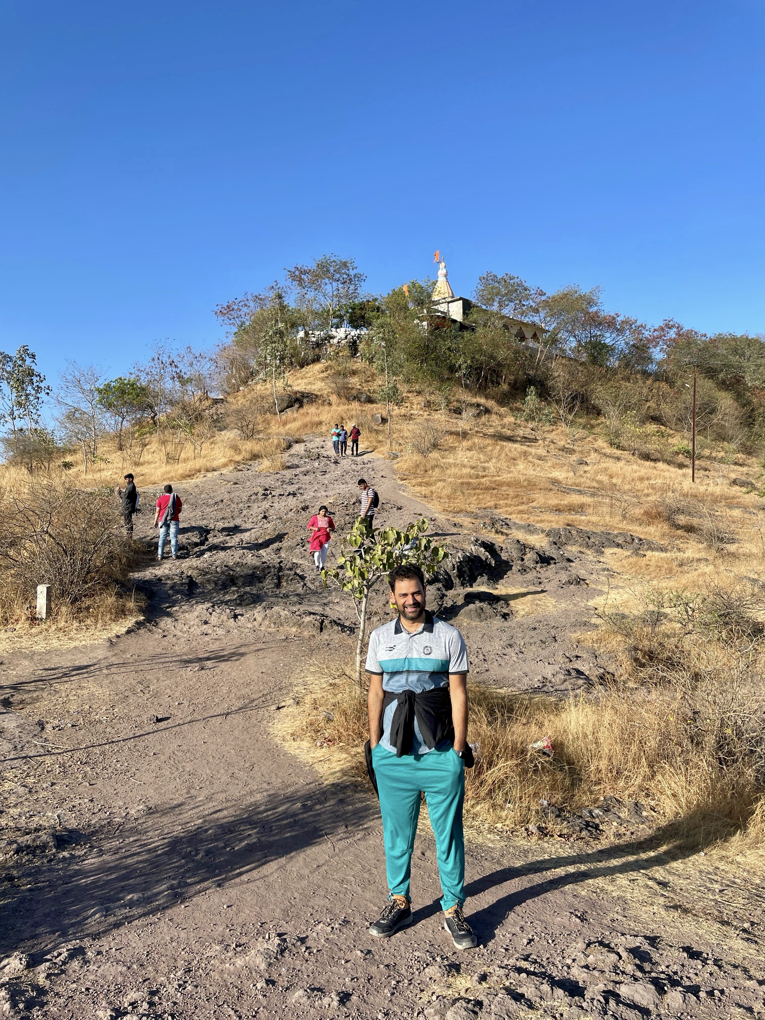
    The entire trek distance of kanifnath trek is around 2.5 km. The trek is of easy nature except a few difficult patches. The trek takes around 45 minutes to complete each side. The entire trek duration is around 1.5 hours.

       The only difficult patch of Kanifnath trek

    Due to the easy nature of the trek it can be easily done by the children. It is in this context that Kanifnath trek is an ideal location for a morning family outing.

       Children Enjoying the Morning trek at Kanifnath

    View of Sunrise at Kanifnath Trek

    Along with the darsan to Kanifnath temple the view of sunrise is the most important attraction of Kanifnath trek. The cool breeze of Western Ghats fills you with energy and positivity. If you start the trek early you can easily reach at the top before sunrise and enjoy a beautiful view of sunrise from the top.

    Visit to Kanifnath Temple

    Kanifnath also known as Khandoba is a Hindu Saint. He is one of the nine Mahayogis of Navnath Sampradaya. Kanifnath is also considered as an avtaar of Narayana. The temple at the top is dedicated to Kanifnath. The temple is grand and beautiful. There are many shops nearby selling local food and fruits. You can just sit and relax inside the temple premises for sometime and then start your return trek. There are many smaller temples inside the temple premises.

    Monsoon season is the best season the do the Kanifnath trek. However the trek can be done in any season and the journey and the the experience is memorable.

    Other Places Near Kanifnath Trek

    The famous Dive ghat is located in the vicinity of the Kanifnath. The Murti of Vitthal prabhu is also located nearby. While visiting the Kanifnath you can also visit Malhargarh Fort( The last fort built by Marathas). There are many good restaurants nearby where you can enjoy a delicious breakfast.

  • Necklace Point and Bhatghar Dam Backwaters:  A Great Place for Half Day Outing!

    Necklace Point and Bhatghar Dam Backwaters: A Great Place for Half Day Outing!

    Necklace Point and Bhatghar Dam are two places located nearby to each other which offer a great natural beauty and beautiful view of the sunset. Both these places are located at a drive of around 1 hr 30 minutes from Pune and are a perfect spot for a half day trip.

    Location of Bhatghar Dam and Necklace Point

    Both Bhatghar Dam and Necklace Point are located at a distance of around 56 and 50 km from Pune respectively on Pune Satara highway. The distance between Necklace Point and Bhatghar dam is around 6 km and Necklace point is located on the way the the Bhatghar dam. If you are visiting the place from Pune, Both these places are located at a distance of around 12 and 7 km from Pune Satara highway. The road is good however the only downside is that it becomes very busy during the weekend especially in the evening.

    Necklace Point

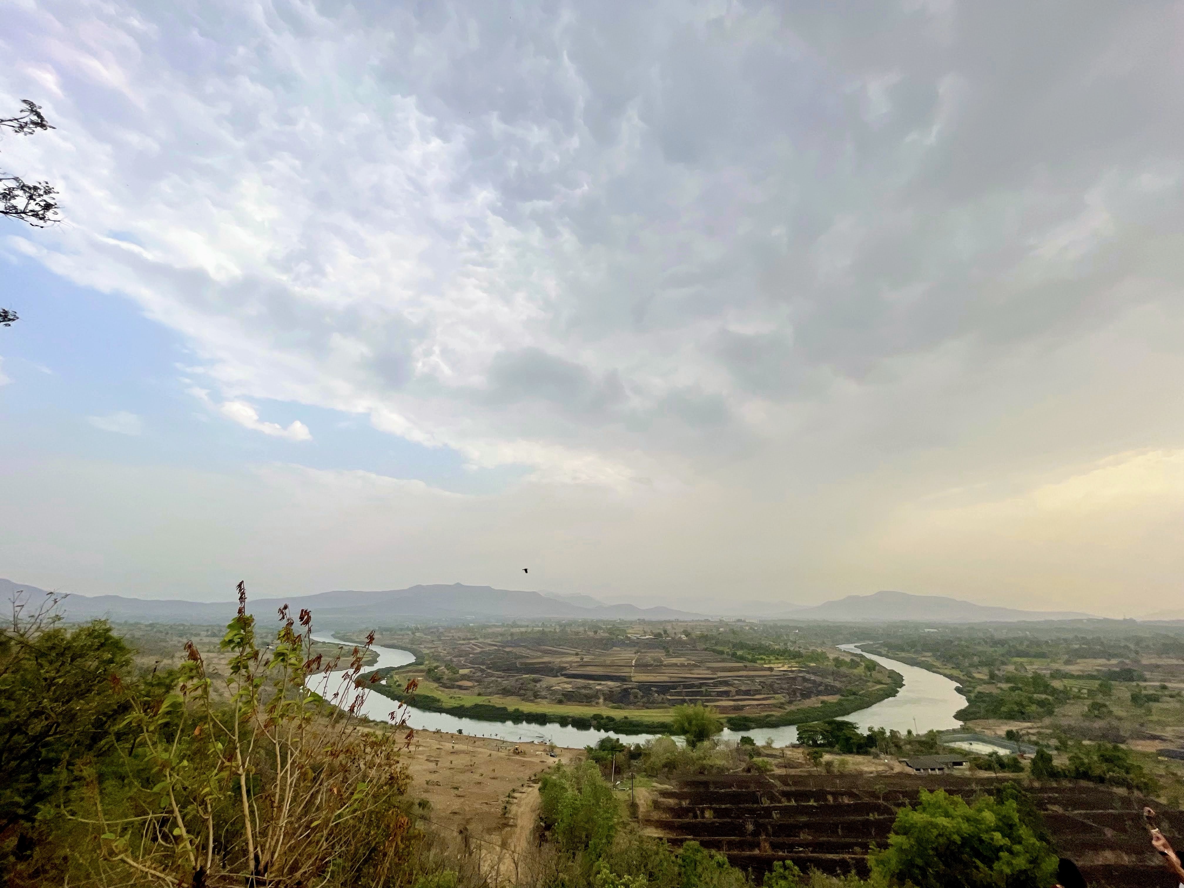
    Necklace point is one of the most famous spots for visitors on the way to Bhatghar dam. At this place River Nira and River Gunjawani meet each other and take a twist to form a shape of a necklace. Necklace point is one of the prime examples of meandering in Western Ghats. The meandering takes place mainly due to siltation and slowing down of the flow of the river. Due to its unique shape the place looks very beautiful from the top.

        View of Necklace Point from the Top.

    The place(Necklace Point) looks very beautiful in the monsoon and the sunset view is amazing here.

    Necklace point view point being located on the main road it is sometimes difficult to find a parking space here. That is the only downside of this place. Also there are no eateries nearby so if you want to have something you have to carry your own food items.

    Bhatghar Dam Backwaters

    Bhatghar Dam is one of the oldest dam in the state of Maharashtra. It is a gravity dam and was built in 1927. The dam is built on Yelwanti River near Bhor are in Pune District.

    Although Pawna Lake is one of the most famous lakes near Pune. However if you are looking for a calm and peaceful outing place with less crowd and great natural beauty, Bhatghar Dam backwaters is a place for you. When I visited the place in the Month of May 2022 there were hardly any visitors. Hence you can get much needed peaceful surroundings here to relax and feel free from the Hustle and Bustle of the city life. The place is quite raw and there is not much commercialisation here. This gives the place a very natural look.

    Sunset at Bhatghar Dam Backwaters

    The best thing about the bhatghar dam is the view of beautiful sunset. The cool breeze of the evening makes the sunset view even more beautiful. You can sit, relax and click few pictures of the sunset. Put you feet in the Lake waters and enjoy an evening watching the sunset with almost no crowd nearby.

    The place is not much commericaised hence you will not find any shop nearby to eat/drink something. Hence it is better to carry our own eatables and enjoy a view of the sunset on the banks of the Bhatghar dam Backwaters.

  • Gorewada Lake Jogging Trail: A Trail for Morning Walk and Bird Watching!

    Gorewada Lake Jogging Trail: A Trail for Morning Walk and Bird Watching!

    Gorewada Lake:Origin and History

    Gorewada Lake is one of the 11 lakes in Nagpur district. The lake is located in the northwestern part of the Nagpur City. Gorewada lake is an artificial lake which was formed by constructing by building a dam like wall.

    Gorewada lake was developed in 1912 to supply the drinking water to the increasing population of Nagpur city. The lake still remains one of the primary source of water supply for the city of Nagpur.

    The lake is surrounded by thick forests from 3 sides. There are many wild animals and birds in the vicinity of the lake. A jungle safari is available in Balasaheb Thackeray Gorewada International Zoological Park. For detailed information please refer- https://gorewadasafari.com/.

    However the topic of discussion for today is Gorewada Nature trail. The trail is around 4 km long and is an ideal spot for morning walk, jogging and running. The trail runs parallel to the Gorewada lake and is an ideal spot for bird watching.

    Key Highlights

    1. Nature Trails

    • The Gorewada Nature Trail offers a peaceful walk through a forested area with well-marked paths. The trails vary in length and difficulty, catering to both casual walkers and more serious trekkers.
    • The trails wind through lush greenery, with plenty of opportunities to observe local flora and fauna. The area is especially vibrant during the post-monsoon season when the forest is dense and the weather is pleasant.

    2. Birdwatching

    • Gorewada is a haven for birdwatchers, with over 200 species of birds recorded in the area. Commonly spotted birds include peafowl, kingfishers, woodpeckers, and various species of raptors and waterfowl.
    • The trail passes near Gorewada Lake, which is an excellent spot for observing waterbirds. Early morning or late afternoon are the best times for birdwatching when the birds are most active.
    Bird Watching in Gorewada Lake

    3. Wildlife

    • The biodiversity park is home to various species of wildlife, including deer, wild boars, and small mammals. Although large predators are not common in this area, the park plays a crucial role in conserving the local ecosystem.
    • The park also has a rescue center for injured or displaced wildlife, contributing to the conservation efforts in the region.

    4. Gorewada Lake

    • The nature trail offers scenic views of Gorewada Lake, a man-made reservoir that provides a tranquil setting for visitors. The lake is surrounded by forest, adding to the serene atmosphere.
    • Visitors can enjoy the calm waters, watch birds by the lakeside, or simply relax and take in the natural beauty.

    5. Environmental Education

    • The park is not only a recreational area but also a center for environmental education. It often hosts workshops, guided tours, and activities aimed at raising awareness about conservation and the importance of preserving natural habitats.

    Gorewada Nature Trail(Ticket Price and Entry)

    The entry fee for the Gorewada nature trail is Rs 30 for adults and Rs 10 for kids. Monthly pass is available for Rs 50. The place is managed by forest department and you are required to show a valid id for entry. There is ample parking space available in the vicinity. The timings for the place is generally from 6 am to 10 am.

    Gorewada lake is an ideal spot for morning walk, run and jogging. If you are a cycling enthusiast you can do cycling upto Gorewada lake entry point and then do a jogging and return back. The place is calm and peaceful with not many people around. Considering its peacefulness it is one of the best places for morning activities in the city of Nagpur.